
Brentwood ZIP Code Directory Coverage
The official Williamson County ZIP map supports a careful, limited answer about the ZIP codes tied to Brentwood. It labels 37027 as the Brentwood zone. City physical addresses, including City Hall, use that delivery ZIP. The City also uses a separate P.O. Box mailing address in 37024. Those are different postal uses, not evidence of two residential areas or a census of people. A ZIP code directory should preserve that distinction, especially when a parcel record and a return address seem to point in different directions.
| ZIP | Officially supported coverage | Postal clue | Record-use note |
|---|---|---|---|
| 37027 | Brentwood delivery zone on the county ZIP map | Brentwood Post Office, 8011 Brooks Chapel Road | Delivery geography, not a city-limit or resident boundary. |
| 37024 | City P.O. Box mailing use | City mailing address uses P.O. Box 788, Brentwood 37024-0788 | Do not call this a separate Brentwood delivery or residential zone. |
No official source in the research established another delivery ZIP for a separate portion of the City of Brentwood. The county map is the useful broad visual source, while USPS is stronger for checking one precise delivery address.
Brentwood ZIP Code Delivery and Boxes
A ZIP code handles mail routing. It does not create an address, decide land use, or set a municipal line. USPS explains that local governments create street addresses and report them to postal address management. That is why a street address, a tax-roll city field, a deed’s legal description, and a ZIP can all be accurate while serving different purposes. The county map labels 37027 for Brentwood, and the City’s use of 37024 for a P.O. Box is a documented mailing practice. Neither label identifies a household.
Use the delivery ZIP as one label to retain with the address. For property work, keep the parcel or map number and the subdivision or lot as well. A historic deed may use a legal description rather than the postal street form. The more stable county identifiers are what connect the current location to older record references.
Note: A postal result confirms routing for the submitted address, not whether a particular person or organization is located there.
Verify a Brentwood ZIP Code First
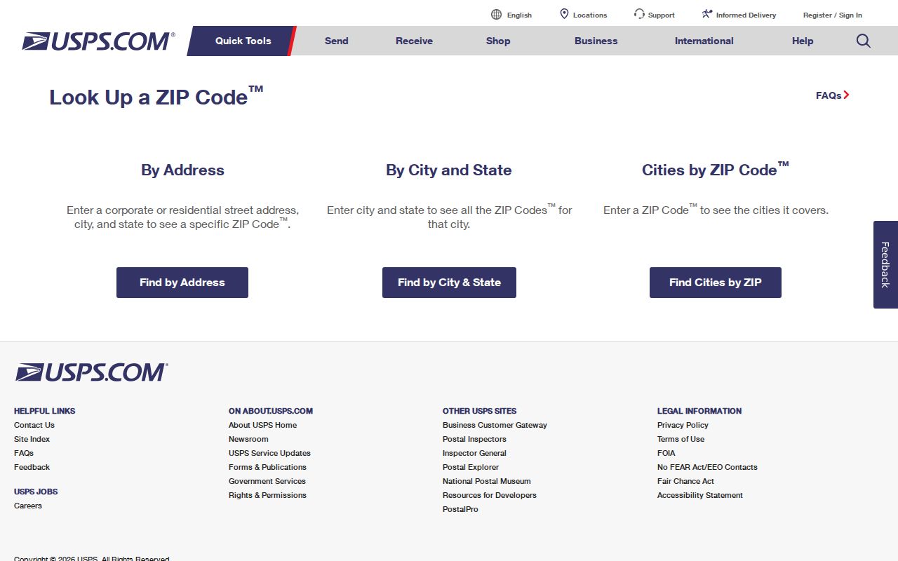
The USPS ZIP Code Lookup offers an address route and a city-and-state route. For a specific Brentwood location, use the complete street address rather than treating a city label as enough. Save the address spelling exactly as returned, including a unit when it applies. USPS expressly cautions that a ZIP result does not confirm that a person or company is at the address, so it belongs at the beginning of geographic verification, not at the end of a people search.
| USPS lookup mode | Best use | What it cannot establish |
|---|---|---|
| By Address | Confirm the delivery ZIP for one complete location. | Parcel ownership, city jurisdiction, or a resident’s presence. |
| By City and State | Check the postal city and ZIP relationship at a broad level. | The exact delivery result for a particular street address. |
USPS’s address-and-city lookup screen is shown below. Its purpose is narrow but important: it helps preserve the postal form before county records introduce a parcel, lot, map, or legal-description clue.
Once the delivery ZIP is confirmed, compare it with the physical street address used by the Assessor and the legal description used in title records.
Brentwood ZIP Code Search Limits
Neither major local lookup becomes a ZIP-wide resident list. Williamson County Property Search exposes Owner Name, Property Address, Subdivision, City, Lot Number, Map, Parcel, and last-sale date fields. ZIP is not an exposed field. The Tennessee Voter Registration Lookup requires county, first name, last name, birth month, and birth year. It has no ZIP field and is designed to confirm one registration, not to browse a postal area.
This limitation is useful. A ZIP code directory can avoid promising a result that the custodian does not provide. The Assessor result is a tax-roll ownership clue, and its owner information does not prove every occupant at a property. The voter screen has protected identifiers and cannot be used to build a street or ZIP roster. For a lawful voter-file request, ask the Williamson County Election Commission about its current form, releasable fields, fee, delivery format, and use certification.
Brentwood ZIP Code to Parcel Workflow
After USPS confirms an address, move through county records one address at a time. This sequence is more reliable than trying to force a ZIP filter into a system that does not have one.
- Confirm the exact address and delivery ZIP with USPS, retaining the spelling used in the result.
- Open Williamson County Online Maps to find the address and its parcel or map reference.
- Use that clue in Williamson County Property Search with the property-address, map, parcel, lot, subdivision, or city fields.
- Keep the resulting owner, parcel description, lot, and sale clues separate from any conclusion about who lives at the address.
- When the question becomes a particular street rather than postal geography, use the Brentwood street directory for the address-by-address record path.
The map gateway also links official ZIP, voting-district, zoning, flood, and civil-district products. Those overlays help explain geography, yet they do not turn the map into an ownership or household roster.
Brentwood ZIP Code and City Geography
Postal geography and municipal jurisdiction do not share one fixed edge. Brentwood’s Urban Growth Boundary is not the same thing as its corporate limits. The City explains that annexation adds property through an owner request or referendum followed by City Commission action. A parcel can therefore require a county property record even when its mailing city says Brentwood, while a City-held permit or municipal record requires a separate custody check for the relevant date.
- ZIP code
- A postal routing code, not a land boundary or proof of a resident.
- ZIP+4
- An added postal routing segment used with a base ZIP; it does not change municipal jurisdiction.
- P.O. Box ZIP
- A code used for box mail. Brentwood’s documented 37024 use is a City P.O. Box mailing use.
- Carrier route
- A postal delivery grouping. It is not a parcel boundary, voter list, or directory of occupants.
A city request should carry the street address and date, while a county title request should also include the parcel, map, lot, subdivision, or legal description when known.
Historic Brentwood ZIP Code Clues
Modern ZIP labels can obscure older references. Brentwood incorporated in 1969, and the City history places earlier community development around railroad-era lot sales. County records may instead use Williamson County, Cottonport, Hardscuffle, Concord Road, Wilson Pike, Franklin, or a land description. These are search terms to test against a known parcel or deed reference, not proof that a modern address had a different number.
For an old address that does not match a current postal form, retain the source date, spelling, road name, and legal-description clue. The Williamson County Archives can use those details to help locate a historical record group. Its online index directs users to microfilm, books, or loose files rather than promising a complete online image collection.
Brentwood ZIP Code Records by Custodian
A correct ZIP is only the beginning of a records request. Williamson County maintains the assessment, property-tax, and ordinary title trail for Brentwood parcels. The Assessor is the starting point for a current parcel and the Register of Deeds is the current instrument custodian. The County Archives is the historical discovery route, with index results that identify a microfilm reel, bound book, or loose file. A postal city in 37027 does not move those county records to City Hall.
The City Recorder has a different, municipal role. It maintains City ordinances, resolutions, minutes, contracts, easements, City-held deeds, legal notices, and records-management material. When a request concerns an existing City permit, agenda attachment, inspection, or municipal document, provide the street address, a date span, and the specific record type. The City’s public-records route explains that a Tennessee-citizen request seeks existing records and does not require the office to create a new directory. The same principle applies to a request framed around a ZIP code: ask for a defined document, not a compilation of residents.
The Brentwood City Recorder public-records channel and the county custodian routes answer different questions. Add the USPS spelling, ZIP, parcel or map reference, and legal description when available. Those details reduce the risk that a postal label sends a request to the wrong office.
Reading the Brentwood ZIP Code Map
The county map page is the stable entry point for the live map and official static map products. Its direct ArcGIS viewer link can change, so the county launch page is the better reference. Start with the ZIP map for broad context, then return to the live map for a parcel clue. Do not assume a boundary line names every parcel in the area, and do not infer a postal boundary from a city label alone.
Brentwood Planning & Codes can address a specific zoning, flood, permit, or address question within its documented functions. The City Recorder holds City ordinances, resolutions, minutes, contracts, easements, and City-held deeds. County Assessor, Register, and Archives records follow county custody. Matching the question to the custodian is the practical value of checking a ZIP code directory carefully.
Note: Keep the delivery ZIP, situs address, mailing address, parcel reference, and legal description as separate fields when they appear in different records.